


 Subscribe to this page(?)
2000 Redistricting
FREDS 2000
The system that was used by Florida for redistricting based on 2000 Census data was called FREDS 2000, (Florida Redistricting Electronic Data System) 2000.
2002 District Information
In the 2002 Legislative Session, the Florida Legislature drew new district lines for the Florida House, Florida Senate and Congressional seats. Below is information on these new districts (descriptions of these data).
These data were generated using a process that may create slivers or small geographic shapes caused by mismatched boundaries between different data sources. Therefore, the data may contain errors and should be used for general analysis only.
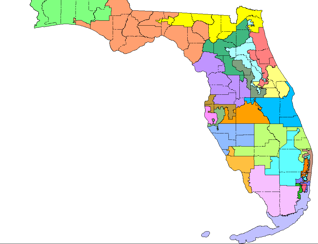
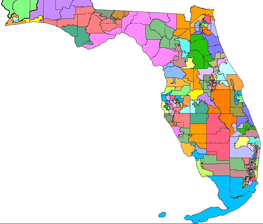
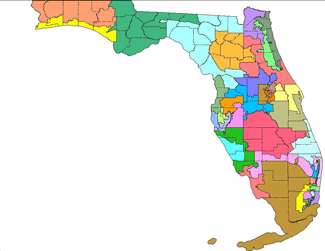
| US Congressional Districts |
Florida House Districts |
Florida Senate Districts |
|---|---|---|
 |
 |
 |
| Counties [xls] | Counties [xls] | Counties [xls] |
| Precincts [xls] | Precincts [xls] | Precincts [xls] |
| Cities [xls] | Cities [xls] | Cities [xls] |
| ZIP Codes [xls] | ZIP Codes [xls] | ZIP Codes [xls] |
| Old Districts [rtf] | Old Districts [rtf] | Old Districts [rtf] |
| Statistics* [xls] | Statistics* [xls] | Statistics * [xls] |
| * Data Dictionary [pdf] for using the Statistics files | ||
2002 District Maps
US Congressional Districts [pdf], Florida House Districts [pdf], and Florida Senate Districts [pdf] maps are available in Adobe PDF format. These maps were designed for printing to a large format plotter (36 inches square), though they may be printed from Adobe Acrobat Reader from any printer. These maps are in excess of 4.6 MB in size and may take a while to download. In addition, ESRI shapefiles (in geographic coordinates with decimal degrees as units and a datum of NAD83) are also available for US Congressional Districts [zip], Florida House Districts [zip], and Florida Senate Districts [zip].
Last Revised: May 21, 2018

